Orienteering is a worldwide sport. It is the aim of the IOF control description symbols to provide a standard means for orienteers from all countries to be able to understand control descriptions without ambiguity or the need for language translation.
How IOF control descriptions work
The purpose of a control description is to give greater precision to the picture given by the map of the control feature, and to indicate the location of the control flag in relation to this feature, thereby helping the competitor to better visualize the control site.
However, a good control is found primarily by map reading. Descriptions and codes can assist in this task, but should be kept as short and simple as is necessary to locate the control.
Note: Control descriptions should not be used to correct map errors.
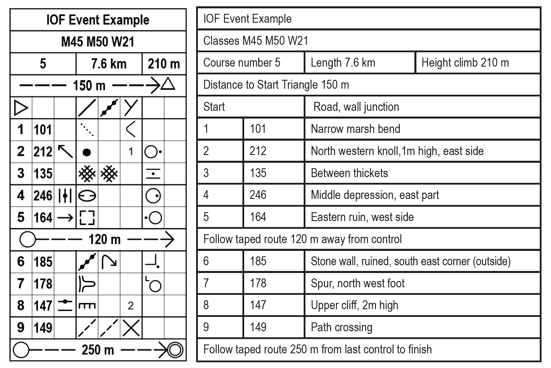
Sample Control Description Sheet
 The table to the left is the type that is typically given to each Orienteer for the Intermediate or Advanced courses. The table to the right or equivalent is provided for the Beginners’ courses.
Resources
This booklet shows how the control description symbols can be used to give more information and “precision” to each of controls’ feature(s) that are marked on the map:
- IOF Control Descriptions 2018: PDF
- Starting on page 18 is a very instructive table of Control Description, Map Symbol, and simple terrain drawing for each of the most common land features.
- IOF Control Descriptions 2018 (in page viewer): [pdfjs-viewer url=”https://neooc.com/wp-content/uploads/2017/12/IOF-Control-Descriptions-2018.pdf” attachment_id=”12347″ viewer_width=100% viewer_height=800px fullscreen=true download=true print=true]
Single page summarys:
Resource files courtesy of IOF, Maprunner UK, and Mike Minimum (OCIN)
READY TO TRY OUT AN ORIENTEERING COURSE?
Click here to see our Upcoming Events…
Click here to find out about our Anytime Permanent courses…