Categories
Course Design Events Mapping NEOOC Orienteering

Cancelled – Campus Map Games Workshop | Kent State U | Saturday, March 14th

Cancelled per KSU, we hope to re-schedule soon. Calling all map freaks! Help create a detailed map of central campus that depicts building outlines, road, sidewalks, sculptures, trees and boulders.  This unlabeled map will be used for an upcoming series of map navigation challenges open to all.   But first, a multitude of details must be […]

Categories
Course Design Events NEOOC Orienteering

Course Design Clinic 2017 | Resources

Thanks for attending today’s Course Design Clinic with Bob Boltz. Here are some of the resources we worked with, along with sample map files, control descriptions, etc.

Categories
Course Design Events Mapping Orienteering Past Events Updates Workshops

Course Design Workshop / Saturday, 18 MAR 2017

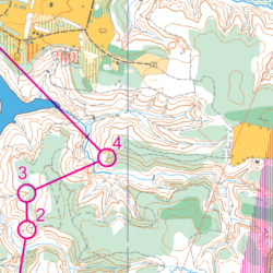
Join NEOOC’s mapping guru Bob Boltz and a few others to learn more about course design, and what it takes to prepare great, but appropriately challenging, maps for all participants – from beginner to advanced orienteers. Topics will include basic design principles, designing for the beginner and advanced orienteer, and how to check your design for trouble areas. You’ll learn how to use Purple Pen, a course design software, as part of the workshop.

Categories
Course Design Maze-O Micro O-Skills Orienteering Training

MAZE-O / Practice Your Skills

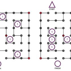
Practice your O-skills even when you’re not out in the woods! The Maze-O will challenge your brain, and sense of direction while finding the shortest, or the fastest routes through the mazes. Each turn slows you down, so try for a straighter line through, with the least amount of turns. And who knows, maybe you’ll see something like this in the near future…

Categories
Course Design O-Skills Orienteering Training

How to Select an Orienteering Course

This is a description of the standard orienteering course levels and the skills required to do each one — ordered from easiest to hardest. This list is to help you decide which orienteering course and/or which training session to select. Above all, remember that orienteering is intended to be fun. Choose the course which challenges your current skill level but is still easy enough to be fun for you.

Categories
Course Design O-Skills OFB Orienteering

Resource / Control Descriptions

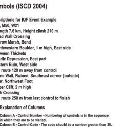
Have you wondered what all those little clue symbols mean? Or need to brush up from last season? Here’s an easy to use control description 1-pager, used with permission from, and developed by Mike Minium of OCIN.

Categories
Course Design Gear Mapping

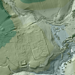
Mapping: 3D Laser Scans of Britain Reveal Ancient Roman Roads

For the past 18 years, the U.K.’s Environment Agency has used a remote sensing methodcalled LIDAR (short for Light Detection and Ranging) to scan and map 72 percent of England’s surface. The 3D terrain images are used to monitor changing coastlines and model floods. But the maps recently revealed something else: an exciting archaeological find. Within the images, experts spotted miles upon miles of ancient Roman roads that may date back as far as the first century CE. Click to read more…