Score Event – find as many controls as possible in a given time limit.
Score Event – find as many controls as possible in a given time limit.
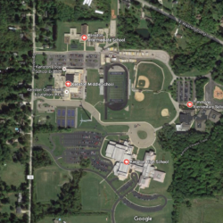
Come run a quick campus, with interesting features including buildings, open paved areas, roads, wooded areas, and water features. Practice those map reading skills by selecting the best route in a limited area. Multiple options for most legs on Orange and above. White and Yellow courses for beginners, with instruction available. The area is very family friendly, with plenty of amenities, restrooms, and a playground for the kids.

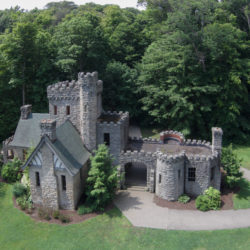
Picture yourself orienteering in the beautiful Cuyahoga Valley National Park just as the leaves are changing in early fall. Call it a ROGAINE, an Adventure Race or an Extreme Navigation Challenge. It all adds up to a long score-style orienteering event in one of the most visited National Parks in America…

Recap Canoe/Kayak Treasure Map Adventure Orienteering at Walborn Reservoir July 17, 2016 via Event Director Ivan Redinger… This has been a great event for some time. It continues to be a great event. With ongoing contributions from many of our club members and the spirit of cooperative enthusiasm, mixed with a hint of friendly competition, […]
Recap The Foot-O was held at Camp Tuscazoar on a hot Sunday afternoon on June 26. The Foot-O event started around 1 pm after the Mountain Bike Orienteers finished. 13 single/team participants attempted the Yellow, Orange, Green, Red and Brown courses. A Hotdog lunch with fixings and NEOOC screen printing was available at the camp. […]
Recap Our Mountainbike-O was held at Camp Tuscazoar on a hot Sunday on June 26. There were a total of 9 single and team participants. 3K and 5K courses were available. Start Times began 10 am. A Hotdog lunch with fixings and NEOOC screen printing was available at the camp. Since this was the first […]
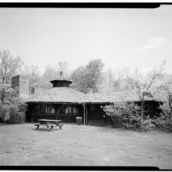
Recap Our annual Twilight Friday event was held at the Octagon Shelter Area near the Ledges in Cuyahoga Valley National Park. Matthew Muffett was the Event Director and Steve Hendrix designed the Courses. Many Thanks to all of our volunteers including Mark Stypczynski and Fran Kern. Results White Course: 9 controls 1 Kelly Gonyias 37:11 […]

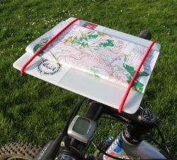
Sign up for Mountainbike-O 2016 – learn more about this event, and let us know you’re coming! This race has no course arrows or other markings. Competitors read a map to find checkpoints. The course is designed so that there are usually a number of route choices to each checkpoint. The map gives clues that will help make good route choices. An explanation of the colors and symbols on the sample map are given at the bottom of this page. Electronic timing will be used at this event! You will receive a printout of your split time for each checkpoint. Starts will be at one minute intervals. You will have the choice of an easier 3 mile race or a rugged 5+ miler.
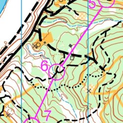
Choose from five courses ranging from 2.1 to 3.5 km. Course Designer, Steve Hendrix, kept them on the short side so you should be able to complete your twilight adventure before dark. Do we need flashlights? Decide for yourself, but a thick leaf canopy + forecast cloudiness + low sun angle could make it hard to read your map.

Orienteering offers many benefits, but its real attraction is that it is fun! It is a joy to walk and run through forests and fields. Armed with a compass and a map, competitors must use their navigational skills to navigate from point to point in diverse and usually unfamiliar terrain, and normally moving at speed.