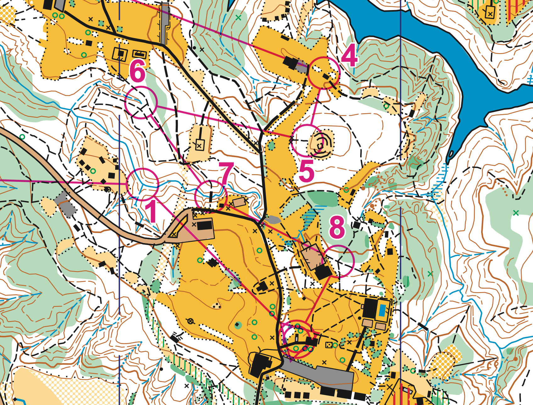
Orienteering is a competitive international sport that combines racing with navigation using a map and compass.
The original, Classic Orienteering format is a timed race in which individual participants use a specially created, highly detailed map to complete a course by selecting routes and navigating through diverse and often unfamiliar terrain and visit Control Points in sequence.
There are other forms of Orienteering that are just as challenging, in which the participants can work together as a team, select which Control Points to visit, and in what order. These are commonly referred to as Score-Os. Note that any form of Orienteering can be done on-foot, in a kayak, on cross county skis, or on a mountain bike.
Mostly importantly, an Orienteering course can simply be enjoyed as a walk in the woods, at your own pace, with difficulty levels from beginner to expert offered at most events.
The Classic Orienteering course consists of a start, a series of Control Points that are marked by circles on the map, connected by lines and numbered in the order they are to be visited, and a finish. The Control Point circles are centered on the land feature that is designated to be found (e.g. a trail junction or big rock, off trail and out in the woods); the feature’s characteristics are further defined by control descriptions (sometimes called clues), a list of which you’ll receive along with your map, or printed on your map. Out in the terrain, a Control Flag, referred to as a Fabric Box in the video above, marks the location (land feature) that the orienteer or team is trying to visit.

To verify a visit, the orienteer usually uses an “electronic punching” system or may use a manual punch for certain events. Manual punches hang next to the flag and are used to mark his or her paper control card. Different punches make different patterns of holes in the paper.
Our club now use “electronic punching” for most events. A finger stick with a chip inside it, records your time at each Control Point that you visit. Place the finger stick’s top into the hole of the Control Box to record your visit (one standard blue electronic control box/reader/station is shown in the video above).
The route taken by the Orienteer between “controls” is not specified, and is entirely up to the Orienteer; this element of route choice and the ability to navigate through the forest are the essence of orienteering.
Many orienteering events are for individuals and use staggered starts to ensure that each orienteer has a chance to do his or her own navigating. But, as previously mentioned, there are several other popular formats, including relays, mass-start endurance events, and “Score-O” events in which the orienteer or team, must find as many controls as possible within a specified time (A Rogaine is an endurance version of a Score-O and can be six or more hours in length).
Originally a training exercise in land navigation for military officers in Scandinavia (See “A brief history,” below), orienteering has developed many variations. Among these, the oldest and the most popular is so-called foot orienteering–this refers to orienteering while running or walking on foot. Typically, when people use the term Orienteering, this is what they’re referring to. But again, now people also orienteer on skis, mountain bikes–even in canoes!
A brief history of orienteering
The history of orienteering begins in the late nineteenth century in Sweden, where it originated as military training. The actual term “orienteering” was first used in 1886 at the Swedish Military Academy Karlberg and referred to the crossing of unknown land with the aid of a map and a compass. The competitive sport began when the first competition was held for Swedish military officers in May 1893 at the yearly games of the Stockholm garrison. The first civilian competition was held near Oslo, Norway, in October 1897.
At the end of World War I, the first large scale orienteering meet was organized in 1918 by Major Ernst Killander of Stockholm, Sweden. Then President of the Stockholm Amateur Athletic Association, Killander was a Scouting movement leader who saw orienteering as an opportunity to interest youth in athletics. The meet was held south of Stockholm in 1919 and was attended by 220 athletes. Killander is credited with coining the Swedish word orientering, from which the word orienteering is derived, in publicity materials for this meet. Killander continued to develop the rules and principles of the sport, and today is widely regarded throughout Scandinavia as the “Father of Orienteering.”
The sport gained popularity with the development of more reliable compasses in the 1930s. The first international competition, between Swedish and Norwegian orienteers, was held in 1932. In 1933, the Swedish compass manufacturer Silva Sweden AB introduced a new compass design, the protractor compass (see left). Until the introduction of the thumb compass, the protractor compass would remain the state of the art in the sport.

By 1934, over a quarter million Swedes were actively participating in the sport, and orienteering had spread to Finland, Switzerland, the Soviet Union and Hungary. The nations of Finland, Norway and Sweden all established national championships, and remain, along with Switzerland, the dominant nations in the sport today. The Swedish national orienteering society, Svenska Orienteringsförbundet, the first national orienteering society, was founded in 1936.
Find out how and when orienteering came to the U.S.
The first international governing body for orienteering was the International Orienteering Federation, which was formed by Bulgaria, Czechoslovakia, Denmark, East Germany, Finland, Hungary, Norway, Sweden, Switzerland and West Germany in 1961. National orienteering federations from 67 different countries, including the U.S. and Canada, are members of the IOF today.
World championships were held biannually from 1961 to 2003, and are now held every year. The only World Orienteering Championship to be held in North America took place at Harriman State Park, just north of New York City in 1993.
via http://www.us.orienteering.org/new-o/what-orienteering
READY TO LEARN ABOUT MAPS? Click here…