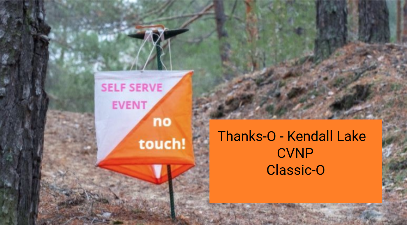
Update – courses are now closed!
NEOOC has picked up all of the flags. We had an overwhelming turn out for this event. Please send us any comments at contact@neooc.com.
If you have not entered your results yet, please do so below. That usage information helps us to determine the effectiveness of these types of events.
Overview
NEOOC, in partnership with the Cuyahoga Valley National Park, is pleased to offer another “self-serve / no touch” orienteering event for exercise and fun.
Similar to the previous events of this type, we will be using the iOrienteering and UsynligO apps for electronic timing on your smart phone. However, all of the courses can be enjoyed without the Tech, by logging the key words on the marker flags as a backup for the apps. There is no need to touch the control flags.
Also, we suggest starting a stopwatch or keep track of your own time by some means, so that you can manually enter your results if needed.
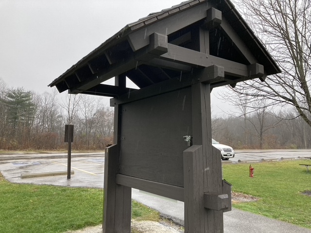
Note that the Start and Finish is located at Pine Hollow (aka Kendall Hills) with parking just off of Quick Road (top of the sledding hills near the building).
Details and Downloads
- Place: Kendall Lake – Pine Hollow – aka Kendall Hills – Cuyahoga Valley National Park; 5523 Quick Rd #5469, Peninsula, OH 44264
- Dates and Times: Wednesday, Nov 25 through Sunday, Nov 29 – Dawn to Dusk
NEOOC has setup a set of Self Serve, Classic Orienteering courses at Kendall Lake – Pine Hollow – Kendall Hills. FULL SIZE control flags are in use and the courses are intended for Novice, Intermediate, and Advanced skill level Orienteers.
PLEASE REVIEW THE WAIVER OF LIABILITY AND ASSUMPTION OF RISK BEFORE DOWNLOADING ANY COURSE MAP FROM THIS WEBPAGE. BY DOWNLOADING A MAP YOU ARE AGREEING TO THE TERMS OF THIS WAIVER AND ARE ABSOLVING NEOOC AND ORIENTEERING USA , ET AL OF LIABILITY RESULTING FROM YOUR PARTICIPATION IN THE ASSOCIATED ORIENTEERING ACTIVITY.
The map used for these courses is an 1 : 10000 scale Orienteering map and was created by NEOOC’s Bob Boltz.
Three courses are available (Click link to download the map PDF file):
-
- Novice (Yellow Course skill level* – 2.3 km) (QR code on map or event code: gpGOI9 (fifth letter is a capital I))
- Orange (Intermediate skill level – 3.9 km) (QR code on map or event code: rGIJFp (third letter is a small letter L))
- Green (Advanced skill level – 4.7 km) (QR code on map or event code: pNkYSy)
- Map Legend
For the map page included in each download, use portrait mode for the printout on 8 1/2 by 11 inch paper. We added the separate Map Legend PDF file because we needed to allow for overlays (like QR codes, clues, etc.) which were written over the legend OR cropping that may have eliminated the legend.
On the iOrienteering App, “Load an Event” page, the Event Code can be used instead of scanning the setup QR code on the map. It is a six character, case sensitive unique code and requires an Internet connect for download of course information to your phone.
*A Yellow Course follows the trails in the park, but requires short off-trail excursions to find many of the controls.
Park Usage and Guidelines
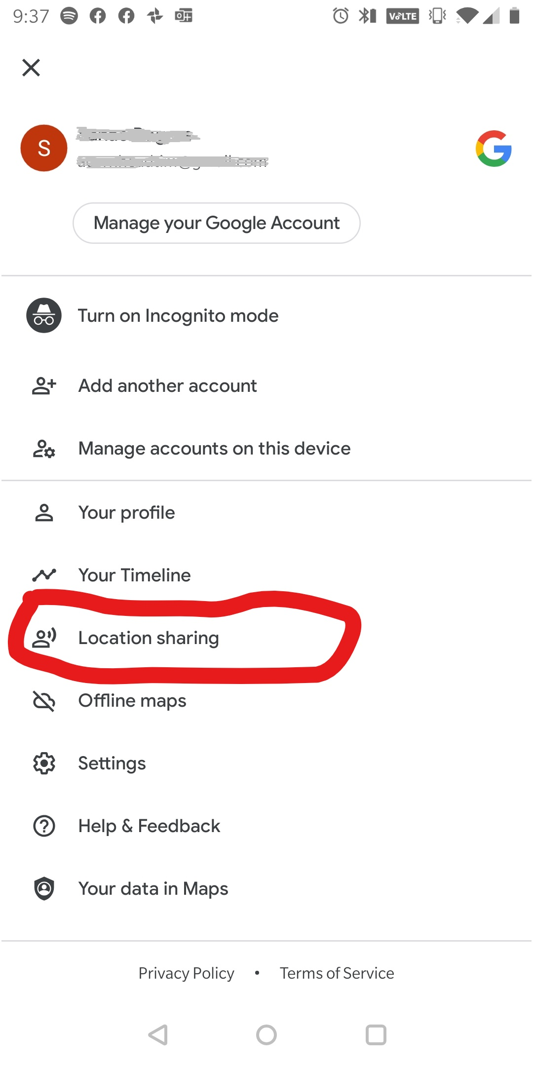
TELL SOMEONE WHAT YOU ARE DOING AND WHEN YOU EXPECT TO RETURN. SAFETY FIRST! (see Sanae’s location sharing idea below)
Contact Fred Mailey, Event Director (fred@neooc.com), if you would like him to monitor your run/walk.
Here are our thoughts and guidelines for these Classic-O courses:
-
- Do this as individuals only or in your cohort. As part of your essential exercise program, while maintaining social distancing.
- The Start (QR code) is located on the Signage Kiosk near the Building (see picture in last section below).
- The Finish (QR code) is located on the Signage Kiosk near the Building.
- For these Classic-O courses, the idea is to find them in the specified order (Start -> 1 -> 2 -> … -> Finish).
- But plan a specific amount of time for your course. Find as many control flags-markers as you can, in the time that you have planned. It can be one hour or up to three hours. It’s up to you.
- If you are having trouble finding a particular control flag, skip it. No problem.
- Have fun and get some exercise. Do not over do it. Know your limits. Consult your Healthcare provider for guidance as needed.
- Time limit of 3 hours. Once the clock starts, it keeps going, no time off for breaks. Come back well before dark.
- Record the Key word from each control flag-marker you find. Use the sheet included on the map. Bring your own pen! – “No-Touch”
- Or use the iOrienteering Phone App to record the control flags found. This app uses the QR codes attached to each flag and at the Start/Finish areas, see the details in this document: iOrienteering Instructions. – “No-Touch”
- Courses also available at UsynligO and Livelox. Send your splits and/or track to contact@neooc.com via the App’s sharing functions
Pack a lunch, snacks, and plenty of water. Make a day of it. Email questions to contact@neooc.com.
Course Designer’s Notes
- No water stations have been provided on the courses. Participants will need to bring their own supply of water!
- Please respect private property, and and areas within the park that CVNP has designated as off limits. Stay within the park boundaries and outside of the out-of-bounds areas as shown on the map. Thank you.
Cost
Zero! No charge!
However, consider one of the following to support NEOOC:
- Become a NEOOC member on our Membership page
- Or Donate to our map fund at the bottom of the same page
Smart Phone Apps
The iOrienteering Phone App uses QR codes mounted on the control flags and at the Start and Finish. This strives to make the course completely “no-touch”.
To use this app, once you have selected the course that you will be running and have downloaded the map, you will need to load the course details to your phone. You can do this either by entering the 6-character course short code that’s printed on your map (this requires a good internet connection), OR by scanning the QR code that’s printed on your map. Once the course details are loaded, then it’s a simple matter of scanning the QR codes at each of the control markers on your course, including Start and Finish.
If you have any questions, or experience any issues that we can help with, drop an email to mike@neooc.com.
The UsynligO app uses the GPS location provided by your smart phone to log the time that you arrive at the controls on your course. See the UsynligO topic on the Tools for Orienteers page of the NEOOC website for details.
BONUS!! If you’ve wanted to be able to replay your run in RouteGadget, but either didn’t have a means to record your GPS track or go through the steps to upload it to the RouteGadget server, the free Livelox smartphone app may be for you! NEOOC are looking at how this app might fit into our toolbox, and has set up the Sippo Lake event in Livelox to see how it goes. Those that wish to continue to record their tracks using a GPS watch or other means can do so, and upload their route to the Livelox server later.
If you are interested, here are couple of short YouTube videos that demonstrate Livelox’s replay capability, and how to set up and use the app on your smartphone.
Demo of Livelox Replay Capability
Volunteers
A big thanks to our volunteers:
- Course design: Steve Hendrix
- Course setting: Hendrix Family
- Control Collection: Steve Wells, Jay Smink
- Park liaison: Howard Montgomery
- Map Preparation: Bob Boltz, Andreas Johansson
- Result entry and phone app help: Fred Mailey
- Event Director: Fred Mailey
Reporting your Personal Results
NEOOC has setup a webpage to self report your results:
Your results will be added to the Results list below once we have transferred the information properly. It may take a little while. This is completely on the honor system. Have fun!
Or send an email to fred@neooc.com indicating your team name, course, number of controls found and total time.
If you used the iOrienteering App, just upload when you are finished and we will process your results into the Results list below. But if you would like to submit your own, with a different name and/or more detailed comments, go ahead! We will replace our entry with yours in such a case, as soon as we can.
We encourage you to report your results, even if you did not get all of the controls! (Just enter your team name, the number of controls found, and approximate time taken on the webpage. Easy!)
Seeing the Overall Results
Note that you can upload your GPS file on LiveLox and see your route in comparison to others. Use the Event “hamburger” near the top left side. And click “Add Route”. You must be logged into your LiveLox account, then you can upload.
Location
Kendall Lake – Pine Hollow – Kendall Hills.
Notes, Tips, Photos, etc.
Kendall Lake – Pine Hollow – Kendall Hills Signage Kiosk:
Sanae’s location sharing idea:
I found neat function in Google Map. It’s called “location sharing”. You can turn the function on with your family or friend and let them know you will be in the woods and approx. how long, or by when you will be back.
If something happens on you, they will know your location and call rescue or come find you ☺