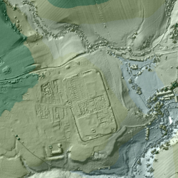

For the past 18 years, the U.K.’s Environment Agency has used a remote sensing methodcalled LIDAR (short for Light Detection and Ranging) to scan and map 72 percent of England’s surface. The 3D terrain images are used to monitor changing coastlines and model floods. But the maps recently revealed something else: an exciting archaeological find. Within the images, experts spotted miles upon miles of ancient Roman roads that may date back as far as the first century CE.
Roman squads who invaded Britain in 43 CE constructed a series of roads that crisscrossed the country, allowing soldiers to travel hundreds of miles to far-flung forts and settlements. These routes helped solidify Rome’s control over the country’s native Celtic tribes. While some of these paths remain today, many eroded over the centuries, or were obscured by new structures or vegetation.
History buffs regularly search for these “lost” routes, the Times of London reports. Among that group was a 70-year-old retired road engineer named David Ratledge, who has spent almost five decades researching vanished highways in the northwest county of Lancashire.
After the Environment Agency made its LIDAR data sets public via the Survey Open Data Website in 2013, Ratledge examined the maps and spotted a Roman road that connects the towns of Ribchester and Lancaster. According to LiveScience, he previously spent years looking for this particular route, to no avail. Thanks to LIDAR —which can detect differences in the land’s height as little as five centimeters (about 2 inches)—the mystery was finally solved.
“Previously in Lancashire we only had aerial photographs from the 1940s and 1960s to go on, but with photographs features only show up after a drought and we don’t get many of those!” Ratledge said in a press release. “With LIDAR, once you know what to look for, it’s blindingly obvious—you just know you’ve found a road.”
Meanwhile, two archaeologists, Hugh Toller and Bryn Gethin, have used LIDAR data to locate other lost highways, including swaths of a Roman route called the Maiden Way. The Maiden Way once connected the village of Kirkby Thore—which was home to a Roman cavalry camp—with a Roman fort in Low Borrowbridge, Cumbria. Eventually, Toller and Gethin hope to find even more Roman roads using images captured by remote sensing technology. These discoveries may help historians gain a fuller understanding of how Rome once conquered and controlled England.
via http://mentalfloss.com/article/75298/3d-laser-scans-britain-reveal-ancient-roman-roads