Categories
Course Design O-Skills Orienteering Training

How to Select an Orienteering Course

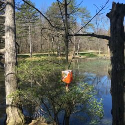
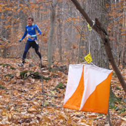
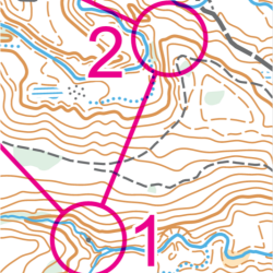
This is a description of the standard orienteering course levels and the skills required to do each one — ordered from easiest to hardest. This list is to help you decide which orienteering course and/or which training session to select. Above all, remember that orienteering is intended to be fun. Choose the course which challenges your current skill level but is still easy enough to be fun for you.

Categories
Course Design O-Skills OFB Orienteering

Resource / Control Descriptions

Have you wondered what all those little clue symbols mean? Or need to brush up from last season? Here’s an easy to use control description 1-pager, used with permission from, and developed by Mike Minium of OCIN.

Categories
O-Skills Orienteering Training

Quick Route – How To Overlay Your GPS Route on a Map

Andreas Johansson from NEOOC describes how to overlay your GPS track (from a Garmin device) on a map, and how to adjust the track.

Categories
Events

Racoongaine VII (Western PA) / 20 MAR 2016

In a rogaine-style format, individuals or teams have a fixed time (3 or 6 hours in this event) to visit as many checkpoints as possible; walking, running and resting as they see fit. The checkpoints are spread over a large area, and are pre-marked on a map issued shortly before the start of the event. Point values for visiting each control vary (and are specified in advance) depending on such factors as distance from the start/finish area, elevation, navigational complexity.

Categories
O-Skills Orienteering Training

O-Skills: Using Handrails

Using handrails is an easy way to get from one control to the next. A handrail is a feature you can easily follow out in the woods, like a trail, water feature, distinct contour line (like running along a ridge line), or something similar. In the example below, the trail acts as the handrail from control 1 to control 2.

Categories
Updates

Course Design Workshop Resources / 27 FEB 2016

Here are the resources for the NEOOC Course Design Workshop on 27 February, 2016. Hangouts, slides, resource documents, and map files.

Categories
Course Design Gear Mapping

Mapping: 3D Laser Scans of Britain Reveal Ancient Roman Roads

For the past 18 years, the U.K.’s Environment Agency has used a remote sensing methodcalled LIDAR (short for Light Detection and Ranging) to scan and map 72 percent of England’s surface. The 3D terrain images are used to monitor changing coastlines and model floods. But the maps recently revealed something else: an exciting archaeological find. Within the images, experts spotted miles upon miles of ancient Roman roads that may date back as far as the first century CE. Click to read more…

Categories
Orienteering Videos

Train Hard Win Easy – The Hubmann Brothers

Daniel and Martin Hubmann – the two world orienteering championships medallists!